
Home › Castle court records / Old sources › Perthées's map of 1786
An early map
Mappa szczególna woiewodztwa lubelskiego — a detailed map of the Lublin Voivodeship, 1786
The sheet of Karol de Perthées at the full resolution of the scan — to pan and zoom. The villages of the hearth tax card file are marked on a separate layer; it can be switched off to look at the engraving alone.

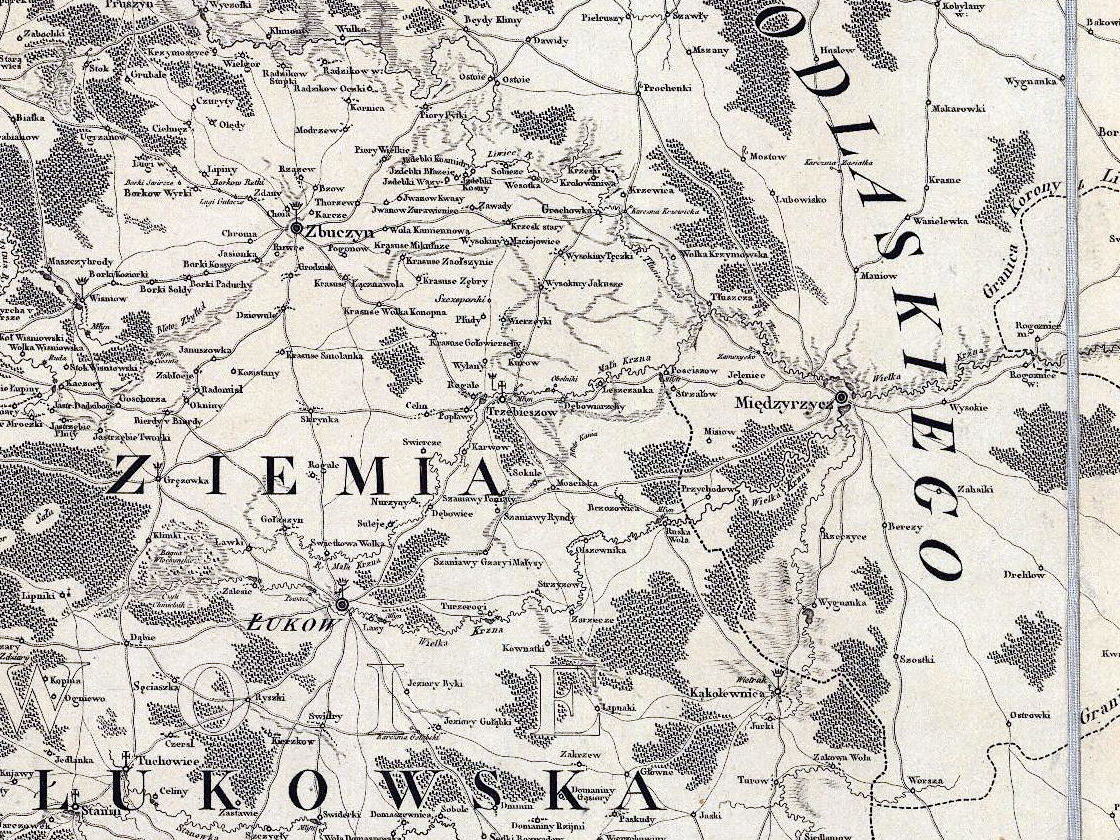
The view opens on the neighbourhood of the card file villages, at the scale of the scan; The whole sheet shows the whole voivodeship. Zooming is done with the + i −buttons, the mouse wheel or two fingers; a zoomed map is moved by dragging — on a touch screen with two fingers, so that one finger still scrolls the page. The name of a village appears when the pointer rests on its mark — or when the village is picked from the list above this paragraph, which brings the map to the spot.
Where this map comes from, and what is on it
Karol de Perthées (1739–1815), court geographer to King Stanisław August, drew his detailed maps of the voivodeships as the first survey of the country made village by village. The Lublin sheet came out in 1786 — three years before the hearth tax register of 1789 and a year before the census of 1787, from which the hearth tax study is made. It is a map of the same age as those registers: it shows the very world they count.
Bogumił Szady calibrated this sheet against the coordinates of its own graticule and obtained a root mean square error of 156 metres (Mapa województwa lubelskiego Karola Perthéesa z 1786 roku jako źródło kartograficzne i historyczne [The Lublin voivodeship map of Karol Perthées of 1786 as a cartographic and historical source], 2012). For an eighteenth-century map that accuracy is surprising — so the differences between what is seen here and a present-day map come mostly from our own reading of the engraving, and from villages that really did move.
Resolution. We show exactly as much detail as there is in the scan we have (4200×6464 px for the whole sheet). Zooming stops at the 1:1 scale of that file, because beyond it the picture would begin to blur rather than show more. A better scan of this map — and of a dozen other early maps of this area — has been published by the Institute of History of the Polish Academy of Sciences in its geoportal Mapy z przeszłością (Maps with a Past).
The folds of the sheet. The map was kept folded, and we show the photograph of it as it is: pale bands run along the folds, and on them the engraving is hidden or shifted. We do not retouch this — it is a photograph of an artefact, not an illustration to be improved. Names that fell on a fold therefore have to be checked against a better scan.
Photograph of the sheet from the collection of the owner of this site; cropped, tonally levelled and cut into tiles when the page was built. The village marks come from the study The hearth tax of the Łuków Land 1775–1794 and are described there.